After the June 21 bike ride, which I was surprisingly asked to navigate, I decided to compile the library of all the GPS data on rides the Palm Meadows group has done since I joined the group in December 2008. I have not done all the rides, but I have done a lot of them. Google Earth allows the compilation of all this data, and you can turn on / off individual rides like layers in a picture. So, after uploading all the GPS data into Google Earth, I turned on all the ride data, and I got a picture that I call Happy Trails.
Some of the longer rides that others in the group have done go out of the picture due to the scale of the picture. Palm Meadows is by Ramagondanahalli in the left-center of the picture. Jessica's school is the white spot South of Hegondanahalli, which is due South of Ramagondanahalli. Bengaluru proper is West and out of the picture. Most of the rides are in farm country and through the various villiages. Those trails traveled frequently are brighter red. Likewise, those trails that are not are not so thick and red.
Years ago, Alli and I ran into a poem called The Calf Path, by Sam Walter Foss. After my commentary on the June 14 ride following cow paths, Arun had responded that indeed, many of the paths in India are exactly that - people following where the cattle went. And anyone who has ever been around cattle know that they do not walk in a straight line. At any rate, looking at my composition photo of the trails reminded me of the poem, and I had to re-read it. I am now pondering the poignantcy of the contrast of the picture and the poem.
skip to main |
skip to sidebar
Karnataka Tabbies is about the Thorne family relocation to Bangalore, India. The tabbies are Ti and Jac, the "boys", who are traveled with us. We are now home in the USA.
About the Thornes in India

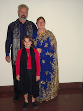
- Larrie, Allison, and Jessica Thorne
- The Thornes and "the boys" are from Minneapolis, USA, and spent 32 months in Bengaluru on a work assignment. In May 2011 we returned to the USA.
No comments:
Post a Comment